The following links can connect you with detailed information about the places featured on HikePix. These details when coupled with HikePix photographs can help you discover, select, and prepare for what may become some very memorable adventures. If any links appear to be faulty or if you would like to suggest a hiking information link, please contact us.
MASTER RESOURCES FOR HIKING
All Trails
Hike St. George
Jerry Arizona
Joe’s Guide to Zion National Park
Leave No Trace
ARCHES NATIONAL PARK, UTAH
ARIZONA WAYPOINTS
BANDELIER NATIONAL MONUMENT, NEW MEXICO
BONNEVILLE SALT FLATS, UTAH
BRYCE CANYON NATIONAL PARK, UTAH
CALIFORNIA STATE DESERT
CANYONLANDS NATIONAL PARK, UTAH
Island in the Sky District official website
CAPITOL REEF NATIONAL PARK, UTAH
CATHEDRAL GORGE STATE PARK, NEVADA
CEDAR BREAKS NATIONAL MONUMENT, UTAH
DEAD HORSE POINT STATE PARK, UTAH
DEATH VALLEY NATIONAL PARK, CALIFORNIA
DINOSAUR NATIONAL MONUMENT, UTAH
DIXIE NATIONAL FOREST, UTAH
Ashdown Gorge Trail
Brian Head Peak
Bristlecone Pine Trail
Cascade Falls
Duck Creek Pond
Highway 14 Drive
Navajo Lake Shoreline
Kanarra Falls Trail
FREMONT INDIAN STATE PARK, UTAH
GLEN CANYON NATIONAL RECREATION AREA, ARIZONA
Lake Powell and Glen Canyon Dam
Horseshoe Bend
GOBLIN VALLEY STATE PARK, UTAH
GRAND CANYON NATIONAL PARK, ARIZONA
Official website – North Rim
Official website – South Rim East
GRAND STAIRCASE-ESCALANTE NATIONAL MONUMENT, UTAH
GRAND TETON NATIONAL PARK, WYOMING
GREAT BASIN NATIONAL PARK, NEVADA
GUNLOCK STATE PARK, UTAH
Gunlock Upper Falls – Accessed by walking across the earthen dam. Falls are often dry but beautiful, and are spectacular when flowing. Falls started flowing again in March 2023 after several dry years. Use extreme caution on wet slickrock.
Gunlock Lower Falls – Trailhead on west side of the road just below the earthen dam
Gunlock Slot Canyon Trail
Gunlock Box Canyon – Located at a turnout less than a mile south of Gunlock State Park on the east side of the road.
IDAHO STATE
INDIANA STATE
Mill Race Park Area
Indiana Caverns
Ogle Lake Trail 7
JOSHUA TREE NATIONAL PARK, CALIFORNIA
KANAB AREA, UTAH
Angel Canyon Cave
Coral Pink Sand Dunes
Sand Caves
Water Canyon
Belly of the Dragon
Wire Pass to Buckskin Gulch
KODACHROME BASIN STATE PARK, UTAH
LOS ANGELES AREA, CALIFORNIA
Hollywood Sign – Mt. Lee
Los Angeles Arboretum
MAUI, HAWAII
Road to Hana
Haleakala National Park
MESA VERDE NATIONAL PARK, COLORADO
MEXICO
MONTEZUMA NATIONAL MONUMENT, ARIZONA
Montezuma Castle
Montezuma Well
MONUMENT VALLEY, ARIZONA
MOUNT RAINIER NATIONAL PARK
Official website
Laughingwater Trail to Silver Falls
Box Canyon Trail
NEVADA WAYPOINTS
Lake Mead
Seven Magic Mountains
Lake Mead and Hoover Dam
Laughlin Labyrinths
Mojave Lake Baker Dam Colorado River
NEW YORK STATE
NORTH CASCADES NATIONAL PARK, WASHINGTON
Skagit River – Enters the park from the west
Ladder Creek Falls Trail
OHIO STATE
Chapin Forest Trails
Hopewell Mound City Site
Seip Earthworks Site
Serpent Mound Site
ORANGE COUNTY AREA, CALIFORNIA
Crystal Cove State Park
Crystal Cove Historic Beach
Laguna Beach and Bluffs
Little Corona del Mar Beach
Redwoods Grove Trail
Top of the World Viewpoint – Drive to the viewpoint on top or hike up from the bottom.
Balboa Island Loop – Park near Balboa Pier, take ferry to the island.
Balboa Wedge – At the southern end of the Balboa Peninsula along the jetty.
OREGON STATE
Latourell Falls
Multnomah Falls
Columbia River Scenic Drive
PROVO AREA, UTAH
Ashton Gardens
Bridalveil Falls
Provo Canyon Drive
Rock Canyon
Y Mountain Trail
Timpanogos Cave Trail – Cave may be closed seasonally or due to rockfall, but trail to locked gate provides scenic canyon views.
American Fork Canyon – Many places to explore along the Alpine Loop Scenic Drive that starts in this canyon and exits in Provo Canyon.
RED CANYON, UTAH
Castle Bridge Trail
Hoodoo Loop Trail
RED CLIFFS NATIONAL CONSERVATION AREA
Official website
Rainbow Canyon Rim Trail – Not a named trail (or canyon, as far as I could find). Park next to the Babylon Road mileage sign 0.2 miles north of the Toquerville Mine parking lot. A partially overgrown two-track trail (now closed to motor vehicles) starts here. The out and back trail is about 0.75 miles one way, and there are many faint footpaths to the west of the trail leading to the canyon edge.
RED ROCK CANYON NATIONAL CONSERVATION AREA, NEVADA
SALT LAKE CITY AREA, UTAH
SAN DIEGO AREA, CALIFORNIA
Cabrillo National Monument
Carlsbad Beach
Carlsbad Flower Fields – Seasonal. Located in Carlsbad at 5704 Paseo Del Norte. Exit Interstate 5 at Palomar Airport Road, flower fields located a few short blocks east of the Interstate.
Granite Loop Trail
Harveston Lake
Oceanside Jetty
Point Loma Cliffs
San Juan Loop
Torrey Pines Beach and Broken Hill Loop
Torrey Pines Glidersport Cliffs
Torrey Pines Guy Fleming Trail
Vernal Pool Trail
Moonlight Beach
Walker Canyon Superbloom
SANTA CLARA RIVER, UTAH
Santa Clara River Headwaters to Drainage
SEATTLE AREA, WASHINGTON
Mukilteo Lighthouse Beach
Possession Point Trail
Washington Park Arboretum
Snoqualmie Falls State Park
SEDONA, ARIZONA
Sedona hikes and drives
Bell Rock Trail
Crescent Moon Ranch
Seven Sacred Pools Trail
Slide Rock Park
Yavapai Vista Trail
SNOW CANYON STATE PARK, UTAH
Snow Canyon Petroglyphs – Park at large turnout on the west side of Highway 18 about 1/4 mile south of 4200 N street. Hike west on trails of use about 0.25 mile to gravel and dirt road. Hike north about 0.6 mile to a wire fence stretching across road (no trespassing). Hike west on trail of use on south side of wire fence until you see the canyons below. Follow trail of use to an opening under the wire fence into Snow Canyon (day use fee or annual pass required). Navigate using All Trails map (download to phone before hiking). The trail is not well marked until arriving at Gila Trail, which is part of the petroglyph loop. Newspaper Rock and Shipwreck Rock are along the way heading northwest, both have petroglyphs. You can see a signpost for the Gila Trail from Shipwreck Rock about 100 yards to the west. Southbound Gila Trail leads downward to a junction with a creek bed marked with signage. Follow creek bed east a few hundred yards until signs and cairns indicate hiking south into the petroglyph slot canyon.
ST. GEORGE AREA, UTAH
Anasazi Valley Petroglyphs – Park in overflow lot, ascending trail to the right avoids switchbacks and is more scenic. Before leaving area, go a short way farther on the dirt road to an interesting Native American village display.
Aspiration Trail
Baker Lake
Bloomington Petroglyph Park
Buckeye Reef and Ruins – The Silver Reef Museum is located in the heart of a historic and beautiful mining district. Docents can provide directions for getting to the nearby OHV trails that lead to dozens of mine sites suitable for external exploration.
Cedar Pocket Wash
Children’s Forest at the Kiln
Chuckwalla Trail
Cinder Cone Trail
Claim Jumper Trail
Confluence Park Trails
Dino Cliffs
Dino Tracks and Red Reef East Area
Enepitsi (Ghost) Trail
Fire Lake Park
Fort Pearce – The map and address on the BLM page is incorrect. The fort is located on Warner Valley Road as described in the narrative.
Gecko Trail
Glitter Mountain
Grafton Ghost Town
Grandpa’s Pond Park
Green Valley Gap Trail
Hurricane Fault Lift – Can be seen from SR-9 a little east of I-15, from SR-7 a little east of Sand Hollow, and from Warner Valley Road exit east from SR-7.
Jacob Hamblin Trail – Jacob Hamblin was a frontiersman and ambassador to Native American tribes who explored much of the southwest in the mid-to-late 1800s. Out and back hike starts at the Jacob Hamblin historical home (which has an interesting historical tour), then the trail winds to the west for about a half mile passing through the site of the old Santa Clara Fort that was destroyed by flood and ending at the Santa Clara cemetery where several members of Jacob Hamblin’s family are buried. Click here for directions.
Kayenta Bend Trail – Trailhead on south side of Old Highway 91 directly across from Kayenta Parkway. Also referred to by climbers as Shotgun Alley.
LaVerkin Gorge – Part of Confluence Park. Use SR-9 trailhead near bridge, exit several hundred yards west of historic power plant via switchback trail. and staircase.
LaVerkin Overlook
Little Black Mountain Petroglyphs
Little Black Mountain Spur – Exit Southern Parkway at Desert Canyons Parkway, go south about half a mile.
Little Black Mountain Trail
Lower Bearclaw Poppy Trail
Mayor’s Loop
Mountain Meadows Memorial Trails
Owens Loop
Paradise Rim Trail
Pioneer Park
Pushing Tin Trail
Red Cliffs Anasazi Trail
Red Hills Desert Garden
Red Reef Trail
Quail Creek Shoreline
Ranger Bart Trail
Sand Hollow Shoreline
Sand Mountain – Use the Sand Mountain OHV parking area turning south from State Route 7 on Sand Hollow Road. Hiking is allowed in the area but be aware of OHVs that frequent the trails and be sure to move to safety when you see or hear them approaching.
Santa Clara River Reserve – Accessed from Old Highway 91 a few miles south of the Anasazi Valley Petroglyphs trail.
Santa Clara River Trail
Secret Sauce Trail
Shinob Kibe
Sky Mountain Overlook – Unofficial name, shown on Google Maps as Grapevine Wash area. Park on street in northeast corner of neighborhood about 0.5 mile west of Sky Mountain Golf Course, find off-road vehicle trailhead that leads out onto the bluff, follow several adjacent trails of use to viewpoints. Several good viewpoints near golf course as well.
Stone Quarry Trail
Temple Quarry Trail
Temple Springs Trail
The Boneyard
The Vortex – Bowl
Tonaquint Nature Center
Toquerville Falls
Tuacahn Saddleback Trail
Turtle Wall Trail
Upper Bearclaw Poppy Summit Trail
Veyo Crawdad Canyon – Hiking trails through a private climbing canyon along the Santa Clara River.
Virgin River Canyon Recreation Area
Virgin River Gorge
Virgin River Trail – Starts several miles south at Atkinville Trailhead on Virgin River South Trail. Includes SunRiver Wayside, which is the western end of the paved Virgin River Trail. Ends about a half mile north of Country Way, which is the current eastern end of the paved Virgin River Trail. This route is about 13.5 miles from end to end.
Warner Valley Dinosaur Tracks
Warner Valley Scenic Drive – Exit northbound SR-7 and drive east onto the dirt and gravel road which winds through the valley to multiple points of interest. Some of Kevin Costner’s film Horizon was shot here.
Washington Corral – On the south side of SR-9, 3.4 miles east of LaVerkin and 0.9 miles east of the LaVerkin overlook sign.
White Dome Trails
White Reef and Ruins – The Silver Reef Museum is located in the heart of a historic and beautiful mining district. Docents can provide directions for getting to the nearby OHV trails that lead to dozens of mine sites suitable for external exploration.
Yant Flat
Washington Fields Dam – Upriver side accessible via Washington Dam Road. Downriver side accessible via Landfill Road and off-road trail.
SUNSET CRATER VOLCANO, ARIZONA
TAIWAN
UTAH WAYPOINTS
Castle Valley Overlook Area – Also called Sand Bench view area, located on south side of I-70 about 45-60 minutes west of Highway 24
Lion’s Park Bridge – Near SR-191 where it crosses the Colorado River in Moab.
Otter Creek
Pine Valley
Red Canyon
Utah Lake
Parowan Gap Petroglyph Trail
Parowan Area Dinosaur Track Trail
VALLEY OF FIRE, NEVADA
Official website
Seven Wonders Trail
Fire Caves Area
Fire Wash – Not an official trail. Located on the east side of White Dome Road several hundred yards to the north of Parking 2, walk to where the wash comes up to the road and follow it northeast.
VERMILLION CLIFFS
VIRGIN RIVER
Virgin River Headwaters to Drainage
VIRGINIA
WASHINGTON WAYPOINTS
Bigfoot Park – Entrance located at east end of Espresso Chalet in Index, Washington on Route 2, was a filming location for the movie Harry and the Hendersons
Skykomish River – Located about 1 mile west of Bigfoot Park where the highway crosses the river at the confluence of the North and South Forks of the Skykomish River
Whidbey Island – Southern access is via Mukilteo/Clinton Ferry near Everett, there are many outdoor activities on this sizeable island
WUPATKI NATIONAL MONUMENT, ARIZONA
Wupatki Pueblo Trail
Wupatki Pueblo Trail Guide
WYOMING SEGMENTS OF OREGON TRAIL
Independence Rock
Martin’s Cove
Willie Center to Rescue Site
Rocky Ridge
Rock Creek Hollow
YELLOWSTONE NATIONAL PARK, WYOMING
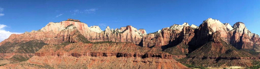
ZION NATIONAL PARK, UTAH
Official website
Joe’s Guide to Zion National Park
There are many unofficial walking paths in Zion. They are located in the areas indicated in gallery titles.
Western Hoodoos
East Canyon Overlook Trail – Located at the first small turnout east of the small tunnel on the north side of Highway 9.
Lower Clear Creek
Eastern Hoodoos – Not an official trail. Located just west of the Checkerboard Mesa on the north side of Highway 9. You can see the hoodoos from the road.
Upper Clear Creek – Not an official trail. There is a prominent rest stop on the south side of Highway 9 a little less than 1 mile east of the small tunnel. Park here, go down the slick rock and hike east into the Clear Creek wash. Note that the Many Pools Trail starts at the first bend in the road east of the rest stop on the north side. If there is enough snow melt or recent rain, the Many Pools Trail can temporarily become the Many Pools Creek. Also, you can hike west in the Clear Creek wash about 1 mile to what is often a dry waterfall, or even further if desired.
Lambs Knoll
Jolley Gulch
Eagle Crags Trail